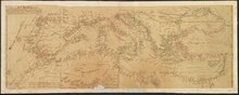
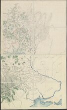
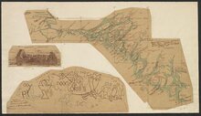
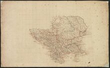
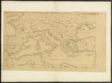
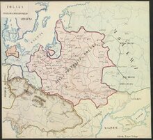
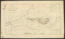
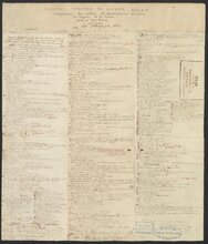
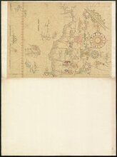
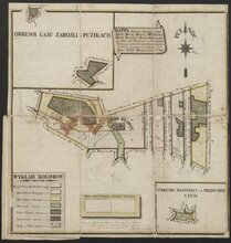
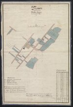
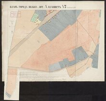
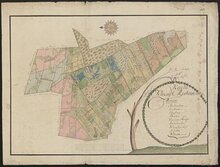
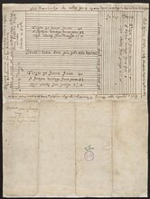
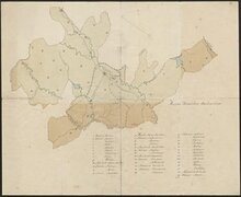
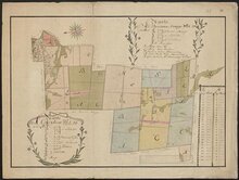
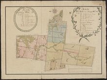
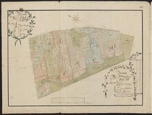
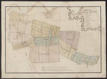
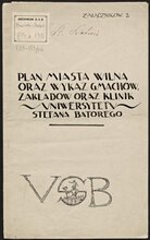
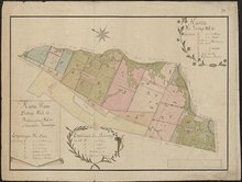
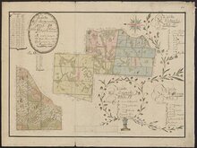
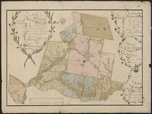
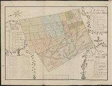
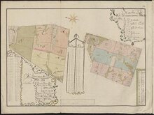
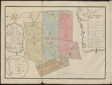
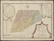
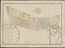
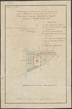
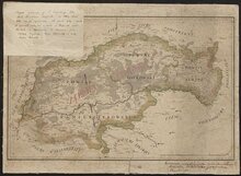
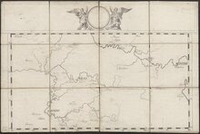
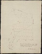
Main menu (english)

  • Collections
  • About
  • Projects
Home
Digital collections
  • en
  • lt

Breadcrumb

  1. Home
  2. Cartography

Cartography

The col­lec­tion of old car­tog­ra­phy – in­clud­ing at­lases, his­tor­i­cal maps, man­u­script plot plans and blue­prints – con­sists of valu­able Lithuan­ian and Eu­ro­pean his­toric and cul­tural her­itage ob­jects, con­stantly un­der scrutiny of sci­en­tists and car­tog­ra­phy en­thu­si­asts alike. The prove­niences of at­las col­lec­tion show that Vil­nius Uni­ver­sity Li­brary’s car­tog­ra­phy col­lec­tion is not only the rich­est in Lithua­nia, but also one of the most unique in en­tire East­ern Eu­rope. Joachim Lelewel’s (1786–1861) per­sonal com­pendium of old car­tog­ra­phy serves as the ba­sis of this col­lec­tion. His man­u­script maps, es­pe­cially con­cern­ing the Mid­dle Ages, are of the ut­most value. Col­lec­tions be­queathed by other donors (Vin­cas Mince­vičius and Va­clo­vas Dar­gužas, among oth­ers) are also heavy with maps and city plans of the 16th–19th cen­turies, de­pict­ing the world, Eu­rope and sep­a­rate re­gions, and cre­ated and pub­lished by fa­mous au­thors and pub­lish­ers of the time. The ma­jor part of man­u­script car­tog­ra­phy sources con­sists of land, vil­lage, town and city plans and de­signs. These are unique mon­u­ments of his­tor­i­cal ge­og­ra­phy that wit­ness the land-own­er­ship processes of the Grand Duchy of Lithua­nia in the 16th–18th cen­turies, help­ing us vi­su­alise the so­cial dy­nam­ics of the time.

Cartography

Filters

Filters

No filters selected.

Kūrėjas

Topic

Kalba

Place

Susiję asmenys

License

Displaying 1 - 30 of 1021

ATLAS

CINQUIESME PARTIE DU GRAND ATLAS : Contenant Vne parfaicte…

CLAUDII PTOLEMAEI Tabulae geographicae ORBIS TERRARUM Veteribus…

2eme Partie : Géographie du moyen Age

TROISIEME PARTIE

PARS TERTIA

VYFDE DEEL

PARS QVINTA

[T. 1] GEOGRAPHIE QVI EST LA PREMIERE PARTIE DE LA COSMOGRAPHIE…

SECONDE PARTIE

DERDE DEEL

SESTE DEEL van de NIEUWE ATLAS, oft Toonneel des Aerdrijcx /…

PARS SECVNDA

TWEEDE DEEL

QVATRIEME PARTIE

PARS QVARTA

VIERDE DEEL

[T. 1]

SECOND VOLVME DE LA GEOGRAPHIE BLAVIANE : CONTENANT LE III, IV, V, VI…

SESTE STVCK DER AERDRYCKSBESCHRYVING : WELCK VERVAT VRANCKRYCK

SEVENDE STVCK DER AERDRYCKSBESCHRYVING : WELCK VERVAT ITALIEN EN…

GEOGRAPHIÆ BLAVIANÆ VOLVMEN QVARTVM : QVO LIBER IX, X, EUROPÆ…

[T. 1]

VYFDE STVCK DER AERDRYCKSBESCHRYVING : WELCK VERVAT SCHOTLANDT EN…

ASIA, QVÆ EST GEOGRAPHIÆ BLAVIANÆ PARS QVARTA, LIBRI DVO VOLVMEN…

TWEEDE STVCK DER AERDRYCKSBESCHRYVING : ´t WELCK VERVAT DVYTSLANDT,…

GEOGRAPHIA QVÆ EST COSMOGRAPHIÆ BLAVIANÆ PARS PRIMA : QVA ORBIS TERRÆ…

AMERICA, QVÆ EST GEOGRAPHIÆ BLAVIANÆ PARS QVINTA, LIBER VNVS VOLVMEN…

EERSTE DEEL DES AERDKLOOTSBESCHRYVING : INHOVDENDE DE AFBEELDINGEN EN…

DERDE STVCK DER AERDRYCKSBESCHRYVING : WELCK VERVAT DE NEDERLANDEN

Pagination

  • Current page 1
  • Page 2
  • Page 3
  • Page 4
  • Page 5
  • Page 6
  • Page 7
  • Page 8
  • Page 9
  • …
  • Next page ››
  • Last page Last »